
As I shared recently in a Newsletter dedicated to London, I really love the UK! The United Kingdom can be very charming and some of its best gems are often left unknown… As a way to wish you a Happy Traveling Year, here’s a little share of the best spots I’ve gotten to discover!
Click here to Watch Online & See the Pictures
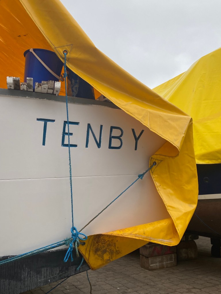
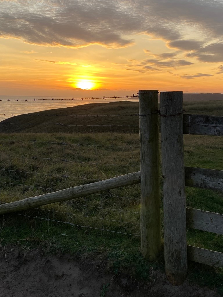
Discover Tenby, Wales’ Gem
Escape to the charming coastal town of Tenby, where every moment feels like a breath of fresh sea air.
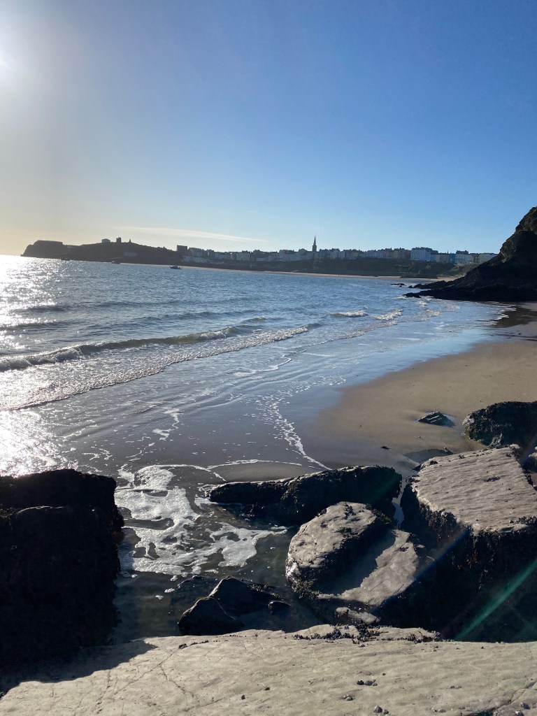
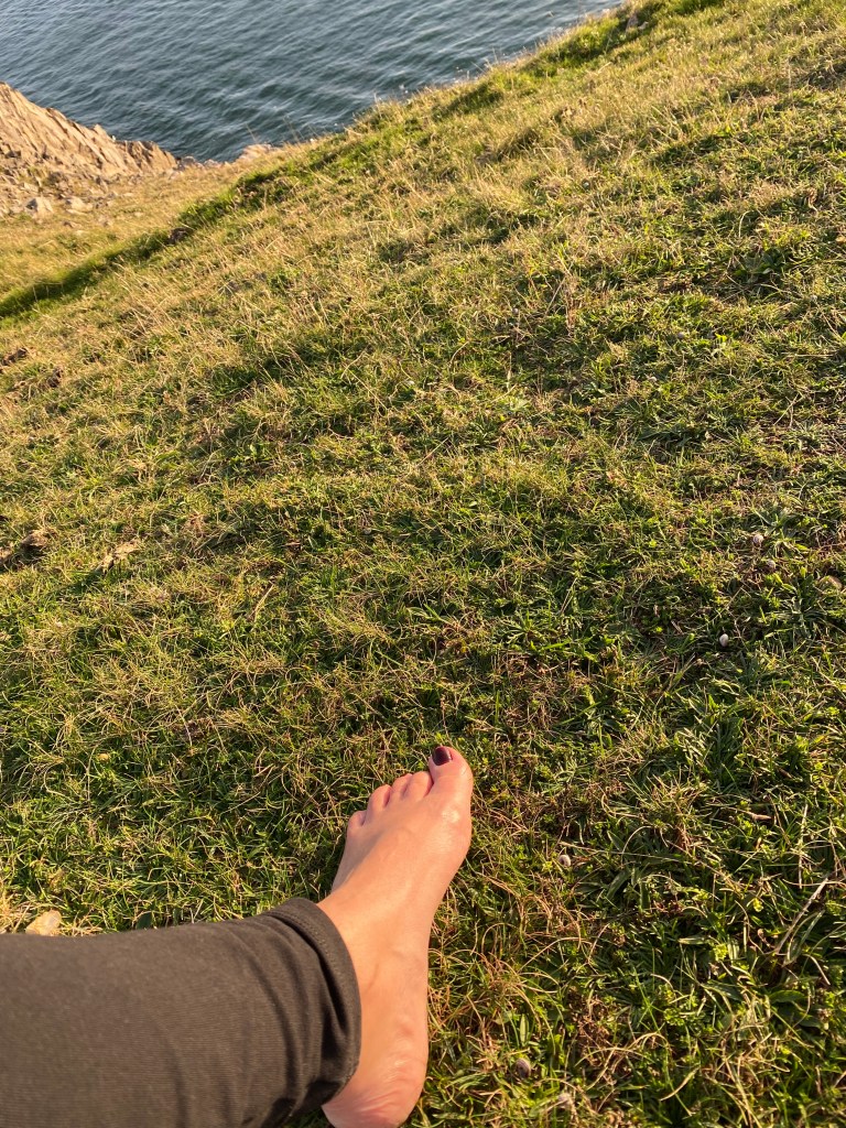
Wander around the harbor, photograph the colorful houses and then go to walk barefoot along the soft cliffs, feeling the earth’s pure & powerful energy beneath your feet as you soak in breathtaking views and the stunning sunsets of the Welsh coastline.


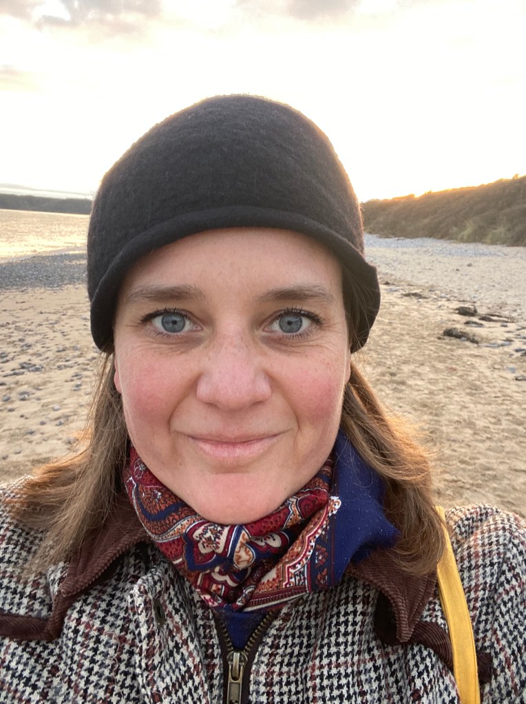
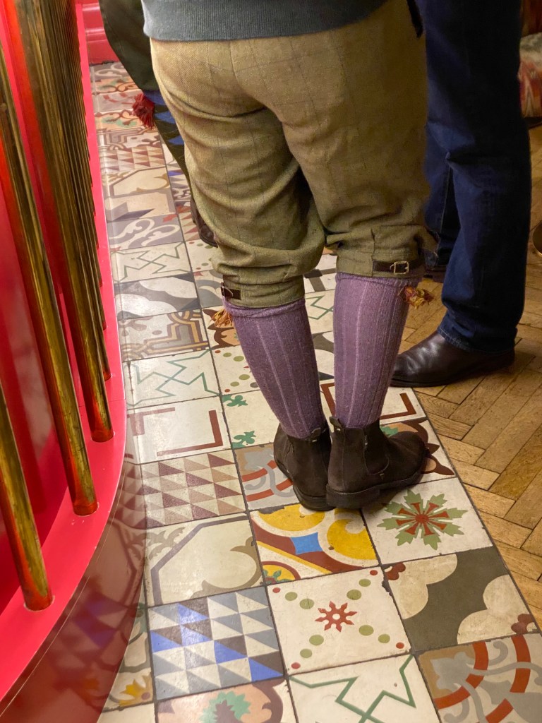
Tea Time!
Did you know that there are still some places in the world where not everything is about money? Yes for real!!! 🙂 Places where human values, friendships and caring about each other are still the main priority. If this is something that could make you feel good about the world we live in again, keep reading…
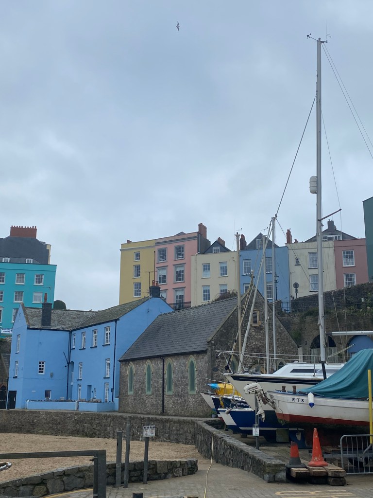
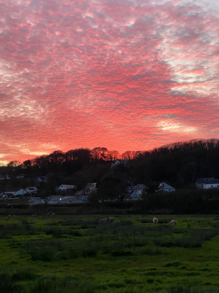
Still in Tenby,
You can come to embrace the warmth of a local community based at the Old Chapel, where an inspiring family, after touring around the world, has decided to offer delicious homemade soups, teas & cake for free or on donations.

Then you can wander through quaint little shops filled with nice local specialties, attend soul-stirring choir concerts or inspiring Art Presentations on Fridays at Saint Johns church.
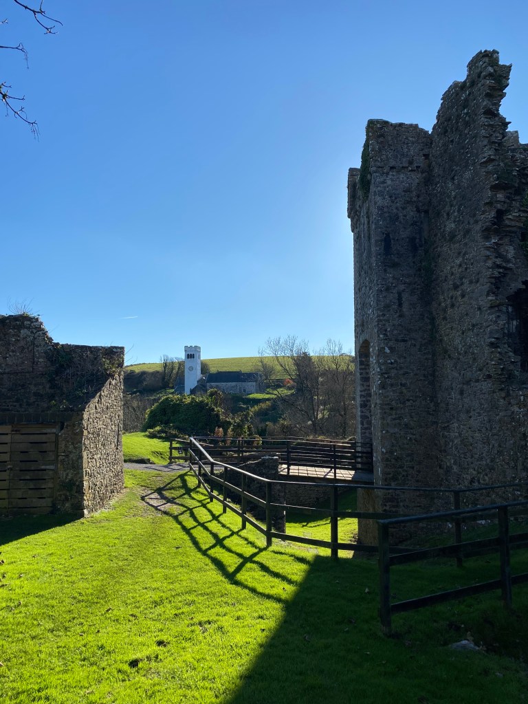
In the area,
I recommend visiting Manorbier Castle for a middle age vestige
and Picton Castle for the amazing gardens and beautiful interiors.

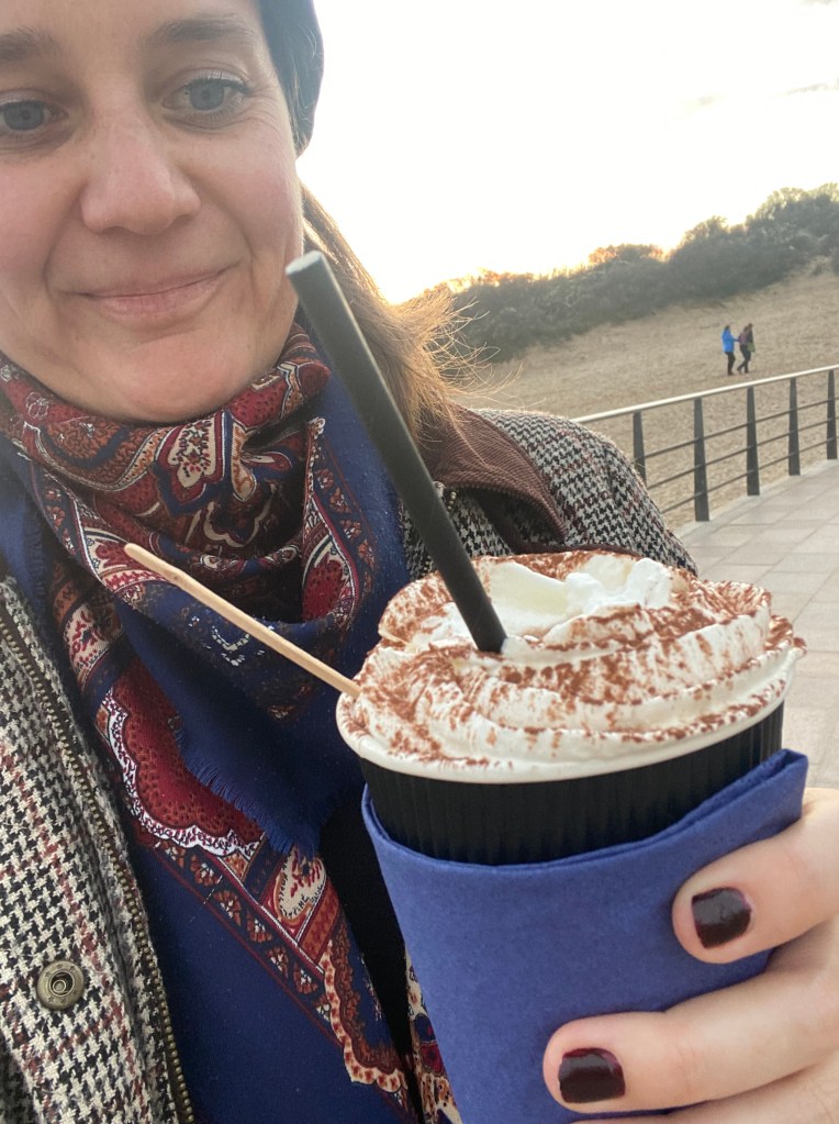
And after those well fought battles,
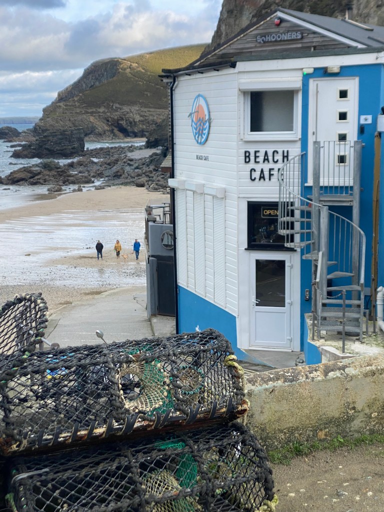
Cozy up at the beach café in South Beach with a rich hot chocolate laced with Baileys! Haha, very cheeky !! 🙂
Also let me know if you don’t know where to stay in Tenby and want affordable accommodation, flat and/or house!
Experience the Timeless Charm
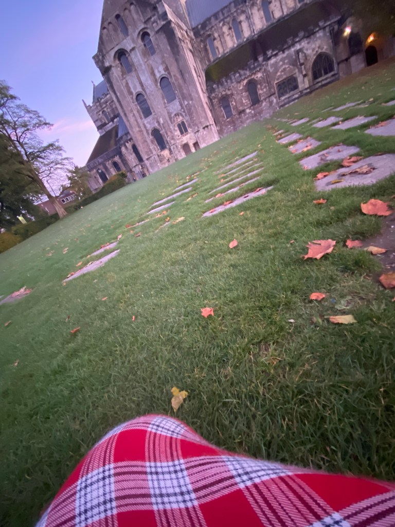
of Stockbridge & Winchester
Nestled in the heart of Hampshire, you can go to discover Stockbridge, a haven for those seeking tranquility and quintessential English charm.
Renowned for the pristine River Test, this little village draws fishermen from far and wide to its world-famous chalk streams. After a day by the river, retreat to one of Stockbridge’s cozy, character-filled pubs for a hearty meal and a pint of local ale.
Surrounded by rolling countryside, Stockbridge is perfect for leisurely walks and exploring nearby trails.
Just a short drive away lies Winchester, a city steeped in history & culture. Marvel at the magnificent Winchester Cathedral, wander through the medieval streets, or visit the Great Hall to see the legendary King Arthur’s Round Table.
Stockbridge and Winchester offer the perfect blend of countryside serenity and historic charm. From there, you can also easily go to watch nice Theatre Plays in Romsey!


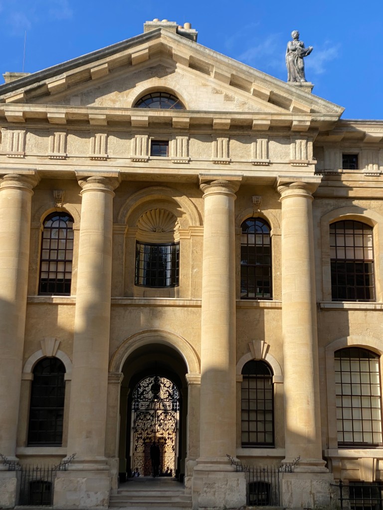
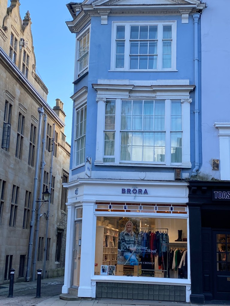
Walk through Oxford Timeless Elegance
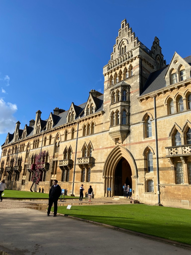
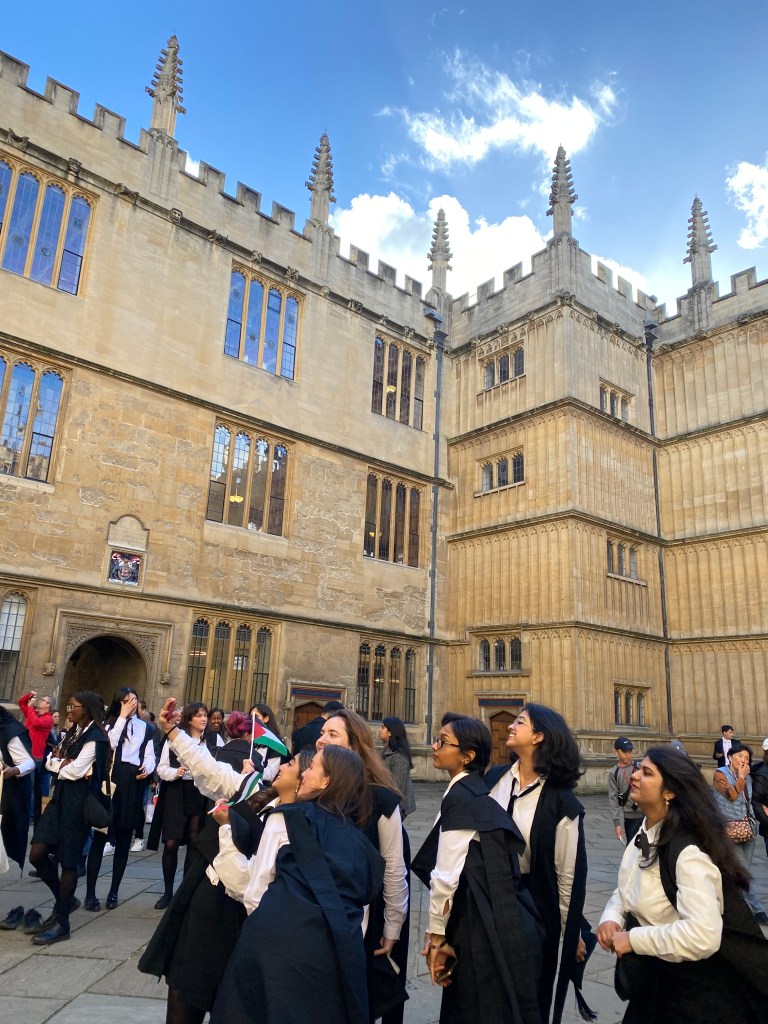
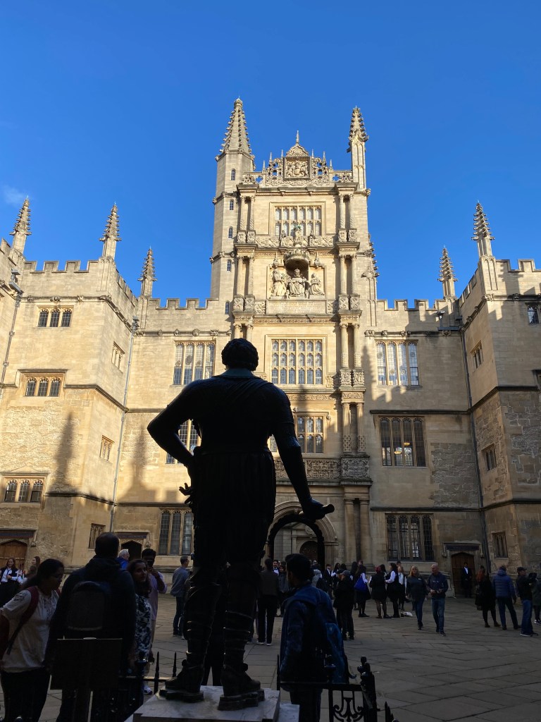
While crossing England, it will be quite easy for you to stop into the enchanting world of Oxford, the City of Dreaming Spires, where history and academia come alive.
Explore the stunning Bodleian Library, one of the oldest libraries in Europe, and its ancient halls. Wander through the cobblestone streets and take in the beauty of the iconic colleges, from Christ Church (a Harry Potter filming location) to Magdalen College, with its tranquil deer park.
Enjoy a serene afternoon punting on the River Cherwell, or immerse yourself in centuries of art and history at the Ashmolean Museum.
TOP TRAVELER TIP: Book everything in advance to visit Oxford!!
– Especially on Saturdays, most points of interest are Fully Booked –
Stroll through the Covered Market, where you will find unique shops and local treats, and then you can go to relax in a historic pub like The Eagle and Child, famously frequented by J.R.R. Tolkien and C.S. Lewis.

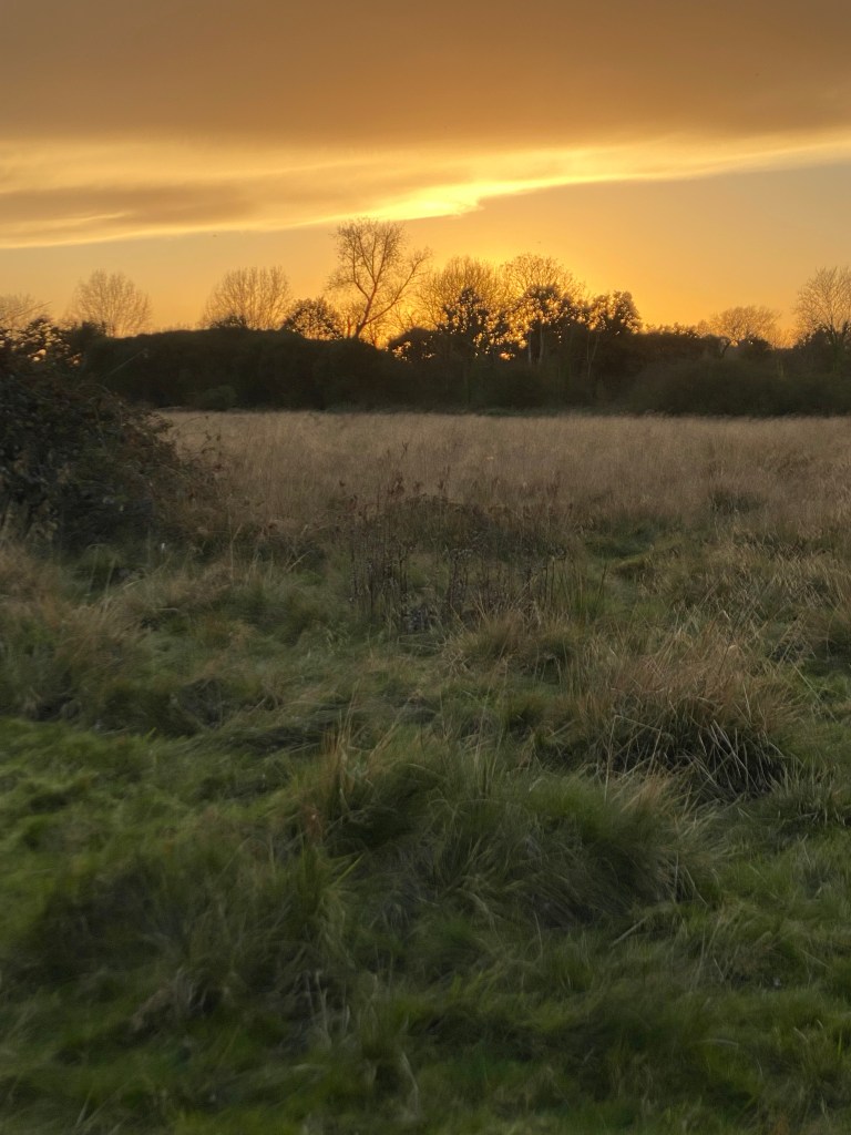
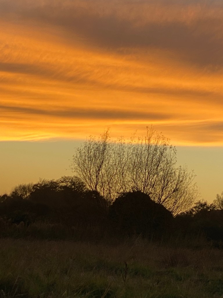
Discover Cornwall
Now breathe in… Breathe out… And go for a huge
Recharge of Oxygen in Cornwall..!
First, once you will arrive in Cornwall,
you will start by eating their Cornish Pasties –
If you do Cornwall my friend, you’ve got to do it well!
Then you will be ready to go…
Fall in Love with Saint-Ives
These days when way too many humans have sold and compromised their souls, it can be easier (and healthier) to fall in love with Stunning Cities – Fall in Love with Nature – Fall in Love with Arts…
Our hearts desperately need to fall in love and luckily, there are many ways to do so.
Love is everywhere and it can be experienced in a thousand forms. Traveling the World will open many of them for you.
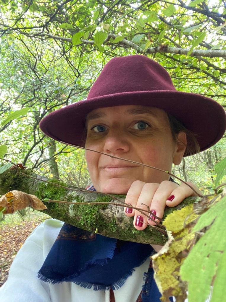
Positive Social Impact
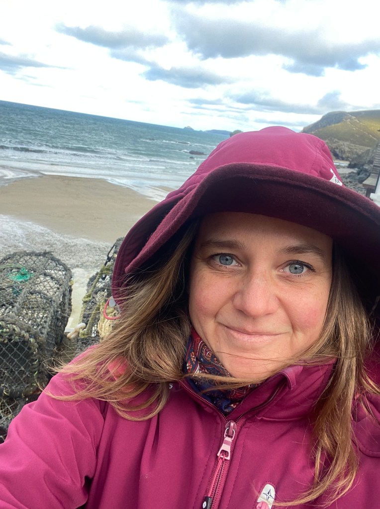
When I arrived in Saint-Ives, I felt like I had won the lottery! Have you ever experienced this traveler’s feeling, when you suddenly discover that hidden gem you had been looking for without really knowing what you were looking for?!
St Ives is a seaside gem that captures the essence of Cornwall’s rugged beauty and artistic soul. The golden beaches, the crystal-clear waters, and charming harbor, make this picturesque town able to offer you the perfect escape with: cobbled streets lined with quirky shops, galleries, cafés, and the iconic Tate St Ives with its vibrant art scene.
I’ve enjoyed the local shops and artist galleries to make all my Christmas gifts so I knew I was supporting local businesses and creative minds. Emi
![Cornwall (/ˈkɔːrnwɔːl, -wəl/;[5] Cornish: Kernow; Cornish pronunciation: [ˈkɛrnɔʊ]; or [ˈkɛrnɔ][6]) is a ceremonial county in South West England.[7] It is recognised by Cornish and Celtic political groups as one of the Celtic nations, and is the homeland of the Cornish people. The county is bordered by the Atlantic Ocean to the north and west, Devon to the east, and the English Channel to the south. The largest urban area in the county is a conurbation that includes the former mining towns of Redruth and Camborne, and the county town is the city of Truro.
The county is rural, with an area of 1,375 square miles (3,562 km2) and population of 568,210. Outside of the Redruth-Camborne conurbation the largest settlements are Falmouth, Penzance, Newquay, St Austell, and Truro. For local government purposes most of Cornwall is a unitary authority area, with the Isles of Scilly having a unique local authority. The Cornish nationalist movement disputes the constitutional status of Cornwall and seeks greater autonomy within the United Kingdom.
Cornwall is the westernmost part of the South West Peninsula, and the southernmost county within the United Kingdom. Its coastline is characterised by steep cliffs and, to the south, several rias, including those at the mouths of the rivers Fal and Fowey. It includes the southernmost point on Great Britain, Lizard Point, and forms a large part of the Cornwall National Landscape. The national landscape also includes Bodmin Moor, an upland outcrop of the Cornubian batholith granite formation. The county contains many short rivers; the longest is the Tamar, which forms the border with Devon.](https://positive-social-impact.com/wp-content/uploads/2024/12/img_8240.jpeg?w=768)

![Cornwall (/ˈkɔːrnwɔːl, -wəl/;[5] Cornish: Kernow; Cornish pronunciation: [ˈkɛrnɔʊ]; or [ˈkɛrnɔ][6]) is a ceremonial county in South West England.[7] It is recognised by Cornish and Celtic political groups as one of the Celtic nations, and is the homeland of the Cornish people. The county is bordered by the Atlantic Ocean to the north and west, Devon to the east, and the English Channel to the south. The largest urban area in the county is a conurbation that includes the former mining towns of Redruth and Camborne, and the county town is the city of Truro.
The county is rural, with an area of 1,375 square miles (3,562 km2) and population of 568,210. Outside of the Redruth-Camborne conurbation the largest settlements are Falmouth, Penzance, Newquay, St Austell, and Truro. For local government purposes most of Cornwall is a unitary authority area, with the Isles of Scilly having a unique local authority. The Cornish nationalist movement disputes the constitutional status of Cornwall and seeks greater autonomy within the United Kingdom.
Cornwall is the westernmost part of the South West Peninsula, and the southernmost county within the United Kingdom. Its coastline is characterised by steep cliffs and, to the south, several rias, including those at the mouths of the rivers Fal and Fowey. It includes the southernmost point on Great Britain, Lizard Point, and forms a large part of the Cornwall National Landscape. The national landscape also includes Bodmin Moor, an upland outcrop of the Cornubian batholith granite formation. The county contains many short rivers; the longest is the Tamar, which forms the border with Devon.](https://positive-social-impact.com/wp-content/uploads/2024/12/img_8241.jpeg?w=768)
![Cornwall (/ˈkɔːrnwɔːl, -wəl/;[5] Cornish: Kernow; Cornish pronunciation: [ˈkɛrnɔʊ]; or [ˈkɛrnɔ][6]) is a ceremonial county in South West England.[7] It is recognised by Cornish and Celtic political groups as one of the Celtic nations, and is the homeland of the Cornish people. The county is bordered by the Atlantic Ocean to the north and west, Devon to the east, and the English Channel to the south. The largest urban area in the county is a conurbation that includes the former mining towns of Redruth and Camborne, and the county town is the city of Truro.
The county is rural, with an area of 1,375 square miles (3,562 km2) and population of 568,210. Outside of the Redruth-Camborne conurbation the largest settlements are Falmouth, Penzance, Newquay, St Austell, and Truro. For local government purposes most of Cornwall is a unitary authority area, with the Isles of Scilly having a unique local authority. The Cornish nationalist movement disputes the constitutional status of Cornwall and seeks greater autonomy within the United Kingdom.
Cornwall is the westernmost part of the South West Peninsula, and the southernmost county within the United Kingdom. Its coastline is characterised by steep cliffs and, to the south, several rias, including those at the mouths of the rivers Fal and Fowey. It includes the southernmost point on Great Britain, Lizard Point, and forms a large part of the Cornwall National Landscape. The national landscape also includes Bodmin Moor, an upland outcrop of the Cornubian batholith granite formation. The county contains many short rivers; the longest is the Tamar, which forms the border with Devon.](https://positive-social-impact.com/wp-content/uploads/2024/12/img_8245.jpeg?w=768)
![Cornwall (/ˈkɔːrnwɔːl, -wəl/;[5] Cornish: Kernow; Cornish pronunciation: [ˈkɛrnɔʊ]; or [ˈkɛrnɔ][6]) is a ceremonial county in South West England.[7] It is recognised by Cornish and Celtic political groups as one of the Celtic nations, and is the homeland of the Cornish people. The county is bordered by the Atlantic Ocean to the north and west, Devon to the east, and the English Channel to the south. The largest urban area in the county is a conurbation that includes the former mining towns of Redruth and Camborne, and the county town is the city of Truro.
The county is rural, with an area of 1,375 square miles (3,562 km2) and population of 568,210. Outside of the Redruth-Camborne conurbation the largest settlements are Falmouth, Penzance, Newquay, St Austell, and Truro. For local government purposes most of Cornwall is a unitary authority area, with the Isles of Scilly having a unique local authority. The Cornish nationalist movement disputes the constitutional status of Cornwall and seeks greater autonomy within the United Kingdom.
Cornwall is the westernmost part of the South West Peninsula, and the southernmost county within the United Kingdom. Its coastline is characterised by steep cliffs and, to the south, several rias, including those at the mouths of the rivers Fal and Fowey. It includes the southernmost point on Great Britain, Lizard Point, and forms a large part of the Cornwall National Landscape. The national landscape also includes Bodmin Moor, an upland outcrop of the Cornubian batholith granite formation. The county contains many short rivers; the longest is the Tamar, which forms the border with Devon.](https://positive-social-impact.com/wp-content/uploads/2024/12/img_8252.jpeg?w=768)
![Stunning arts in Cornwall
Cornwall (/ˈkɔːrnwɔːl, -wəl/;[5] Cornish: Kernow; Cornish pronunciation: [ˈkɛrnɔʊ]; or [ˈkɛrnɔ][6]) is a ceremonial county in South West England.[7] It is recognised by Cornish and Celtic political groups as one of the Celtic nations, and is the homeland of the Cornish people. The county is bordered by the Atlantic Ocean to the north and west, Devon to the east, and the English Channel to the south. The largest urban area in the county is a conurbation that includes the former mining towns of Redruth and Camborne, and the county town is the city of Truro.
The county is rural, with an area of 1,375 square miles (3,562 km2) and population of 568,210. Outside of the Redruth-Camborne conurbation the largest settlements are Falmouth, Penzance, Newquay, St Austell, and Truro. For local government purposes most of Cornwall is a unitary authority area, with the Isles of Scilly having a unique local authority. The Cornish nationalist movement disputes the constitutional status of Cornwall and seeks greater autonomy within the United Kingdom.
Cornwall is the westernmost part of the South West Peninsula, and the southernmost county within the United Kingdom. Its coastline is characterised by steep cliffs and, to the south, several rias, including those at the mouths of the rivers Fal and Fowey. It includes the southernmost point on Great Britain, Lizard Point, and forms a large part of the Cornwall National Landscape. The national landscape also includes Bodmin Moor, an upland outcrop of the Cornubian batholith granite formation. The county contains many short rivers; the longest is the Tamar, which forms the border with Devon.](https://positive-social-impact.com/wp-content/uploads/2024/12/img_8251.jpeg?w=768)
Listen to this amazing concert choir I had the chance to attend!
On TikTok
Or on Instagram (it’s not the same song so you can come on both platforms!)
On Instagram
Please note on Your Adventurer List – based on Wikipedia – that:
The South West Coast Path is England’s longest waymarked long-distance footpath and a National Trail.
It stretches for 630 miles (1,014 km), running from Minehead in Somerset, along the coasts of Devon and Cornwall, to Poole Harbour in Dorset.
– Whoooaaahh!!! Get your hiking boots ready!!! –
Then for you to continue exploring Cornwall’s Hidden Treasures
I give you the exact names to put on your GPS
The wild beauty of Cornwall’s coastline will leave you speechless and these three coves are to be seen, at least once and preferably in the low season so you’ll have it all for yourself!!
- St Agnes enchants with its dramatic cliffs and turquoise waters, perfect for hiking or a refreshing dip
- Porthtowan offers golden sands and world-class surf, ideal for beach lovers and wave chasers alike
- Portreath’s sheltered harbor and quiet charm invite you to unwind and explore its scenic trails
![South West Coast Path
The starting point at Minehead
Length 1,014 km (630 mi)
Location England: Somerset, Devon, Cornwall & Dorset
Designation UK National Trail
Trailheads Minehead: 51.211°N 3.474°W
Poole: 50.680°N 1.950°W
Use Hiking
Elevation change total climbed is 114,931 feet (35,031 m)
Highest point Great Hangman near Combe Martin, 318 m (1,043 ft)
Lowest point sea level
Season all year
Sights Coastal scenery, much of it Heritage Coast
World Heritage Sites: Jurassic Coast and Cornwall and West Devon Mining Landscape
Hazards Cliff paths, river crossings (ferries with limited availability), closure of Lulworth Ranges
National Trails
Acorn_Britain_National_Trails_Symbol-black
Acorn symbol used to guide the route of National Trails
England
Wales
Cross-border
vte
The South West Coast Path is England's longest waymarked long-distance footpath and a National Trail. It stretches for 630 miles (1,014 km), running from Minehead in Somerset, along the coasts of Devon and Cornwall, to Poole Harbour in Dorset. Because it rises and falls with every river mouth, it is also one of the more challenging trails. The total height climbed has been calculated to be 114,931 ft (35,031 m), almost four times the height of Mount Everest.[1] It has been voted 'Britain's Best Walking route'[2] twice in a row by readers of The Ramblers' Walk magazine, and regularly features in lists of the world's best walks.[3]
The final section of the path was designated as a National Trail in 1978.[4] Many of the landscapes which the South West Coast Path crosses have special status, either as a national park or one of the heritage coasts. The path passes through two World Heritage Sites: the Dorset and East Devon Coast, known as the Jurassic Coast, was designated in 2001,[5] and the Cornwall and West Devon Mining Landscape in 2007.[6]
In the 1990s it was thought that the path brought £150 million into the area each year,[7] but new research in 2003 indicated that it generated around £300 million a year in total, which could support more than 7,500 jobs.[4] This research also recorded that 27.6% of visitors to the region came because of the Path, and they spent £136 million in a year. Local people took 23 million walks on the Path and spent a further £116 million, and other visitors contributed the remainder. A further study in 2005 estimated this figure to have risen to around £300 million.[8] Following investment through the Rural Development Programme for England, more detailed research was undertaken in 2012, and this found the annual spend by walkers to have risen to £439 million which sustains 9771 full-time equivalent jobs.[9]](https://positive-social-impact.com/wp-content/uploads/2024/12/img_8331.jpeg?w=768)
![South West Coast Path
The starting point at Minehead
Length 1,014 km (630 mi)
Location England: Somerset, Devon, Cornwall & Dorset
Designation UK National Trail
Trailheads Minehead: 51.211°N 3.474°W
Poole: 50.680°N 1.950°W
Use Hiking
Elevation change total climbed is 114,931 feet (35,031 m)
Highest point Great Hangman near Combe Martin, 318 m (1,043 ft)
Lowest point sea level
Season all year
Sights Coastal scenery, much of it Heritage Coast
World Heritage Sites: Jurassic Coast and Cornwall and West Devon Mining Landscape
Hazards Cliff paths, river crossings (ferries with limited availability), closure of Lulworth Ranges
National Trails
Acorn_Britain_National_Trails_Symbol-black
Acorn symbol used to guide the route of National Trails
England
Wales
Cross-border
vte
The South West Coast Path is England's longest waymarked long-distance footpath and a National Trail. It stretches for 630 miles (1,014 km), running from Minehead in Somerset, along the coasts of Devon and Cornwall, to Poole Harbour in Dorset. Because it rises and falls with every river mouth, it is also one of the more challenging trails. The total height climbed has been calculated to be 114,931 ft (35,031 m), almost four times the height of Mount Everest.[1] It has been voted 'Britain's Best Walking route'[2] twice in a row by readers of The Ramblers' Walk magazine, and regularly features in lists of the world's best walks.[3]
The final section of the path was designated as a National Trail in 1978.[4] Many of the landscapes which the South West Coast Path crosses have special status, either as a national park or one of the heritage coasts. The path passes through two World Heritage Sites: the Dorset and East Devon Coast, known as the Jurassic Coast, was designated in 2001,[5] and the Cornwall and West Devon Mining Landscape in 2007.[6]
In the 1990s it was thought that the path brought £150 million into the area each year,[7] but new research in 2003 indicated that it generated around £300 million a year in total, which could support more than 7,500 jobs.[4] This research also recorded that 27.6% of visitors to the region came because of the Path, and they spent £136 million in a year. Local people took 23 million walks on the Path and spent a further £116 million, and other visitors contributed the remainder. A further study in 2005 estimated this figure to have risen to around £300 million.[8] Following investment through the Rural Development Programme for England, more detailed research was undertaken in 2012, and this found the annual spend by walkers to have risen to £439 million which sustains 9771 full-time equivalent jobs.[9]](https://positive-social-impact.com/wp-content/uploads/2024/12/img_8321-2.jpeg?w=768)
![South West Coast Path
The starting point at Minehead
Length 1,014 km (630 mi)
Location England: Somerset, Devon, Cornwall & Dorset
Designation UK National Trail
Trailheads Minehead: 51.211°N 3.474°W
Poole: 50.680°N 1.950°W
Use Hiking
Elevation change total climbed is 114,931 feet (35,031 m)
Highest point Great Hangman near Combe Martin, 318 m (1,043 ft)
Lowest point sea level
Season all year
Sights Coastal scenery, much of it Heritage Coast
World Heritage Sites: Jurassic Coast and Cornwall and West Devon Mining Landscape
Hazards Cliff paths, river crossings (ferries with limited availability), closure of Lulworth Ranges
National Trails
Acorn_Britain_National_Trails_Symbol-black
Acorn symbol used to guide the route of National Trails
England
Wales
Cross-border
vte
The South West Coast Path is England's longest waymarked long-distance footpath and a National Trail. It stretches for 630 miles (1,014 km), running from Minehead in Somerset, along the coasts of Devon and Cornwall, to Poole Harbour in Dorset. Because it rises and falls with every river mouth, it is also one of the more challenging trails. The total height climbed has been calculated to be 114,931 ft (35,031 m), almost four times the height of Mount Everest.[1] It has been voted 'Britain's Best Walking route'[2] twice in a row by readers of The Ramblers' Walk magazine, and regularly features in lists of the world's best walks.[3]
The final section of the path was designated as a National Trail in 1978.[4] Many of the landscapes which the South West Coast Path crosses have special status, either as a national park or one of the heritage coasts. The path passes through two World Heritage Sites: the Dorset and East Devon Coast, known as the Jurassic Coast, was designated in 2001,[5] and the Cornwall and West Devon Mining Landscape in 2007.[6]
In the 1990s it was thought that the path brought £150 million into the area each year,[7] but new research in 2003 indicated that it generated around £300 million a year in total, which could support more than 7,500 jobs.[4] This research also recorded that 27.6% of visitors to the region came because of the Path, and they spent £136 million in a year. Local people took 23 million walks on the Path and spent a further £116 million, and other visitors contributed the remainder. A further study in 2005 estimated this figure to have risen to around £300 million.[8] Following investment through the Rural Development Programme for England, more detailed research was undertaken in 2012, and this found the annual spend by walkers to have risen to £439 million which sustains 9771 full-time equivalent jobs.[9]](https://positive-social-impact.com/wp-content/uploads/2024/12/img_8225.jpeg?w=768)
![South West Coast Path
The starting point at Minehead
Length 1,014 km (630 mi)
Location England: Somerset, Devon, Cornwall & Dorset
Designation UK National Trail
Trailheads Minehead: 51.211°N 3.474°W
Poole: 50.680°N 1.950°W
Use Hiking
Elevation change total climbed is 114,931 feet (35,031 m)
Highest point Great Hangman near Combe Martin, 318 m (1,043 ft)
Lowest point sea level
Season all year
Sights Coastal scenery, much of it Heritage Coast
World Heritage Sites: Jurassic Coast and Cornwall and West Devon Mining Landscape
Hazards Cliff paths, river crossings (ferries with limited availability), closure of Lulworth Ranges
National Trails
Acorn_Britain_National_Trails_Symbol-black
Acorn symbol used to guide the route of National Trails
England
Wales
Cross-border
vte
The South West Coast Path is England's longest waymarked long-distance footpath and a National Trail. It stretches for 630 miles (1,014 km), running from Minehead in Somerset, along the coasts of Devon and Cornwall, to Poole Harbour in Dorset. Because it rises and falls with every river mouth, it is also one of the more challenging trails. The total height climbed has been calculated to be 114,931 ft (35,031 m), almost four times the height of Mount Everest.[1] It has been voted 'Britain's Best Walking route'[2] twice in a row by readers of The Ramblers' Walk magazine, and regularly features in lists of the world's best walks.[3]
The final section of the path was designated as a National Trail in 1978.[4] Many of the landscapes which the South West Coast Path crosses have special status, either as a national park or one of the heritage coasts. The path passes through two World Heritage Sites: the Dorset and East Devon Coast, known as the Jurassic Coast, was designated in 2001,[5] and the Cornwall and West Devon Mining Landscape in 2007.[6]
In the 1990s it was thought that the path brought £150 million into the area each year,[7] but new research in 2003 indicated that it generated around £300 million a year in total, which could support more than 7,500 jobs.[4] This research also recorded that 27.6% of visitors to the region came because of the Path, and they spent £136 million in a year. Local people took 23 million walks on the Path and spent a further £116 million, and other visitors contributed the remainder. A further study in 2005 estimated this figure to have risen to around £300 million.[8] Following investment through the Rural Development Programme for England, more detailed research was undertaken in 2012, and this found the annual spend by walkers to have risen to £439 million which sustains 9771 full-time equivalent jobs.[9]](https://positive-social-impact.com/wp-content/uploads/2024/12/img_8287.jpeg?w=768)
![South West Coast Path
The starting point at Minehead
Length 1,014 km (630 mi)
Location England: Somerset, Devon, Cornwall & Dorset
Designation UK National Trail
Trailheads Minehead: 51.211°N 3.474°W
Poole: 50.680°N 1.950°W
Use Hiking
Elevation change total climbed is 114,931 feet (35,031 m)
Highest point Great Hangman near Combe Martin, 318 m (1,043 ft)
Lowest point sea level
Season all year
Sights Coastal scenery, much of it Heritage Coast
World Heritage Sites: Jurassic Coast and Cornwall and West Devon Mining Landscape
Hazards Cliff paths, river crossings (ferries with limited availability), closure of Lulworth Ranges
National Trails
Acorn_Britain_National_Trails_Symbol-black
Acorn symbol used to guide the route of National Trails
England
Wales
Cross-border
vte
The South West Coast Path is England's longest waymarked long-distance footpath and a National Trail. It stretches for 630 miles (1,014 km), running from Minehead in Somerset, along the coasts of Devon and Cornwall, to Poole Harbour in Dorset. Because it rises and falls with every river mouth, it is also one of the more challenging trails. The total height climbed has been calculated to be 114,931 ft (35,031 m), almost four times the height of Mount Everest.[1] It has been voted 'Britain's Best Walking route'[2] twice in a row by readers of The Ramblers' Walk magazine, and regularly features in lists of the world's best walks.[3]
The final section of the path was designated as a National Trail in 1978.[4] Many of the landscapes which the South West Coast Path crosses have special status, either as a national park or one of the heritage coasts. The path passes through two World Heritage Sites: the Dorset and East Devon Coast, known as the Jurassic Coast, was designated in 2001,[5] and the Cornwall and West Devon Mining Landscape in 2007.[6]
In the 1990s it was thought that the path brought £150 million into the area each year,[7] but new research in 2003 indicated that it generated around £300 million a year in total, which could support more than 7,500 jobs.[4] This research also recorded that 27.6% of visitors to the region came because of the Path, and they spent £136 million in a year. Local people took 23 million walks on the Path and spent a further £116 million, and other visitors contributed the remainder. A further study in 2005 estimated this figure to have risen to around £300 million.[8] Following investment through the Rural Development Programme for England, more detailed research was undertaken in 2012, and this found the annual spend by walkers to have risen to £439 million which sustains 9771 full-time equivalent jobs.[9]](https://positive-social-impact.com/wp-content/uploads/2024/12/img_8299-2.jpeg?w=768)
![South West Coast Path
The starting point at Minehead
Length 1,014 km (630 mi)
Location England: Somerset, Devon, Cornwall & Dorset
Designation UK National Trail
Trailheads Minehead: 51.211°N 3.474°W
Poole: 50.680°N 1.950°W
Use Hiking
Elevation change total climbed is 114,931 feet (35,031 m)
Highest point Great Hangman near Combe Martin, 318 m (1,043 ft)
Lowest point sea level
Season all year
Sights Coastal scenery, much of it Heritage Coast
World Heritage Sites: Jurassic Coast and Cornwall and West Devon Mining Landscape
Hazards Cliff paths, river crossings (ferries with limited availability), closure of Lulworth Ranges
National Trails
Acorn_Britain_National_Trails_Symbol-black
Acorn symbol used to guide the route of National Trails
England
Wales
Cross-border
vte
The South West Coast Path is England's longest waymarked long-distance footpath and a National Trail. It stretches for 630 miles (1,014 km), running from Minehead in Somerset, along the coasts of Devon and Cornwall, to Poole Harbour in Dorset. Because it rises and falls with every river mouth, it is also one of the more challenging trails. The total height climbed has been calculated to be 114,931 ft (35,031 m), almost four times the height of Mount Everest.[1] It has been voted 'Britain's Best Walking route'[2] twice in a row by readers of The Ramblers' Walk magazine, and regularly features in lists of the world's best walks.[3]
The final section of the path was designated as a National Trail in 1978.[4] Many of the landscapes which the South West Coast Path crosses have special status, either as a national park or one of the heritage coasts. The path passes through two World Heritage Sites: the Dorset and East Devon Coast, known as the Jurassic Coast, was designated in 2001,[5] and the Cornwall and West Devon Mining Landscape in 2007.[6]
In the 1990s it was thought that the path brought £150 million into the area each year,[7] but new research in 2003 indicated that it generated around £300 million a year in total, which could support more than 7,500 jobs.[4] This research also recorded that 27.6% of visitors to the region came because of the Path, and they spent £136 million in a year. Local people took 23 million walks on the Path and spent a further £116 million, and other visitors contributed the remainder. A further study in 2005 estimated this figure to have risen to around £300 million.[8] Following investment through the Rural Development Programme for England, more detailed research was undertaken in 2012, and this found the annual spend by walkers to have risen to £439 million which sustains 9771 full-time equivalent jobs.[9]](https://positive-social-impact.com/wp-content/uploads/2024/12/img_8361.jpeg?w=768)
![South West Coast Path
The starting point at Minehead
Length 1,014 km (630 mi)
Location England: Somerset, Devon, Cornwall & Dorset
Designation UK National Trail
Trailheads Minehead: 51.211°N 3.474°W
Poole: 50.680°N 1.950°W
Use Hiking
Elevation change total climbed is 114,931 feet (35,031 m)
Highest point Great Hangman near Combe Martin, 318 m (1,043 ft)
Lowest point sea level
Season all year
Sights Coastal scenery, much of it Heritage Coast
World Heritage Sites: Jurassic Coast and Cornwall and West Devon Mining Landscape
Hazards Cliff paths, river crossings (ferries with limited availability), closure of Lulworth Ranges
National Trails
Acorn_Britain_National_Trails_Symbol-black
Acorn symbol used to guide the route of National Trails
England
Wales
Cross-border
vte
The South West Coast Path is England's longest waymarked long-distance footpath and a National Trail. It stretches for 630 miles (1,014 km), running from Minehead in Somerset, along the coasts of Devon and Cornwall, to Poole Harbour in Dorset. Because it rises and falls with every river mouth, it is also one of the more challenging trails. The total height climbed has been calculated to be 114,931 ft (35,031 m), almost four times the height of Mount Everest.[1] It has been voted 'Britain's Best Walking route'[2] twice in a row by readers of The Ramblers' Walk magazine, and regularly features in lists of the world's best walks.[3]
The final section of the path was designated as a National Trail in 1978.[4] Many of the landscapes which the South West Coast Path crosses have special status, either as a national park or one of the heritage coasts. The path passes through two World Heritage Sites: the Dorset and East Devon Coast, known as the Jurassic Coast, was designated in 2001,[5] and the Cornwall and West Devon Mining Landscape in 2007.[6]
In the 1990s it was thought that the path brought £150 million into the area each year,[7] but new research in 2003 indicated that it generated around £300 million a year in total, which could support more than 7,500 jobs.[4] This research also recorded that 27.6% of visitors to the region came because of the Path, and they spent £136 million in a year. Local people took 23 million walks on the Path and spent a further £116 million, and other visitors contributed the remainder. A further study in 2005 estimated this figure to have risen to around £300 million.[8] Following investment through the Rural Development Programme for England, more detailed research was undertaken in 2012, and this found the annual spend by walkers to have risen to £439 million which sustains 9771 full-time equivalent jobs.[9]](https://positive-social-impact.com/wp-content/uploads/2024/12/img_8349.jpeg?w=768)
Each cove is a slice of paradise, waiting to steal your heart.
So which one will you explore first?
Leave a Like and a Comment when you like a Newsletter
so I can feel connected to you!
If you need some coaching to find the courage
to go Solo Traveling, Reach out to me!! Emi
If you want to explore the new online space
with Life Challenges articles, click here

Wow 😲 looks amazing sounds exciting to me thank you 😊🏴🌊🏄🏾♀️
LikeLiked by 2 people
I hope you’ll get a chance to go and discover all those places, although you already know one of them very well 🙂
LikeLike
Cornwall sounds enchanting Emilie, a place I could live in!
LikeLiked by 2 people
Who is commenting as it is written Anonymous? Yes Cornwall definitely is a nice place where to live, or Travel and spend time to Discover and see around 🙂
LikeLike
Lovely photos and text, thanks for sharing! 🛵
LikeLiked by 1 person
Have you visited some of them? All of them? Which one is your favorite? Thanks for commenting and bringing life to this blog!
LikeLike
Winchester and the Cathedral certainly. Alas, non of the others on your list. But there is always next time. I have seen new delights each time. What has been your favorite? I’m willing to walk in your footprints, you seem to walk in lovely places.
LikeLiked by 1 person
My fav definitely is Tenby, it’s my first choice to spend long periods of time when I want to rest and settle in a familiar environment – I have friends there and the town and community fulfill all my needs – Oxford is more to visit, really to be a good tourist, for nice getaways and really good spots to visit and deepen your historical knowledge of England + the parks, it’s quite good and often on my way between two locations when I travel through the UK – I’ll definitely share more about my best travel experiences next year so stay tuned!! And have a nice holiday!!
LikeLiked by 1 person